Sight
Canals of Amsterdam
 Andrés Barrios · Wikimedia Commons · CC BY-SA 4.0
Some booking links are affiliate links. If you book through them, we may earn a small commission at no extra cost to you. We never let this influence which places we recommend.
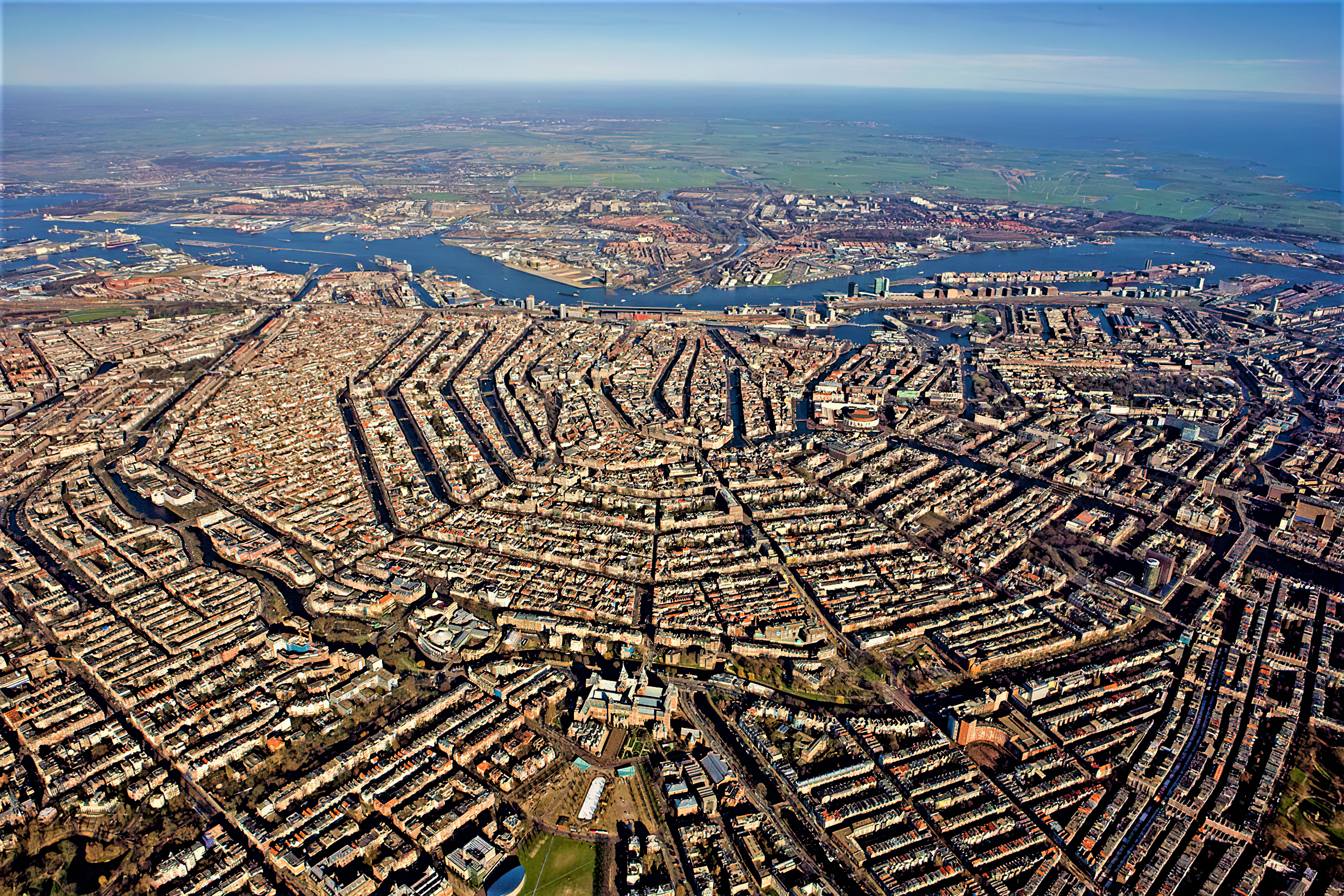
Amsterdam's canals, known as the Grachtengordel, form concentric belts around the city and were dug in the 17th century during the Dutch Golden Age. The three main canals are Herengracht, Keizersgracht, and Prinsengracht. The canal ring area is a UNESCO World Heritage Site, and the city is often called the 'Venice of the North'.
Don't miss
- Herengracht, the Patricians' Canal, features the Golden Bend with double wide mansions
- Keizersgracht, the widest canal, is named after Emperor Maximilian I
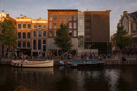
- Prinsengracht, the longest canal, passes the Anne Frank House and Westerkerk
- Singel, the innermost canal, once served as a medieval moat
- Brouwersgracht, voted most beautiful street, has former warehouses now turned into apartments
- Zwanenburgwal, where painter Rembrandt and philosopher Spinoza once lived
Tickets & tours
Ways to visit Canals of Amsterdam
You can usually visit on your own. A tour is worth it for transport, a guide, or combining nearby sights into one day.
 Cheapest way inAmsterdam: Canal Cruise departure from the Anne Frank House4.4★ · 647 travelers~1 hourFree cancellationFrom$16 per personSee dates →
 Most bookedAmsterdam Luxury Canal Cruise + Unlimited Drinks & Bites option4.9★ · 31,477 travelers~1 hourFree cancellationFrom$23 per personSee dates →
 Private & flexibleAmsterdam Your Way: Canals, Hidden Corners & Local Life4.8★ · 251 travelers2-6 hoursFree cancellationFrom$80 per personSee dates →
Know before you go
- Each year, 12,000 to 15,000 bicycles are pulled from the canals in 'bike fishing'
- Many canal houses along Prinsengracht were built during the Dutch Golden Age
- Swimming in canals is not officially encouraged, but locals swim at several locations yearly
A bit of history
The canal system resulted from city planning in the early 17th century, with a plan for four concentric half-circles of canals. Construction proceeded from west to east. The canals were originally for residential development, defense, and water management. Today they are used for tourism, recreation, and houseboats.
Common questions
How many canals are in Amsterdam?
Amsterdam has more than 100 kilometers of canals, about 90 islands, and 1,500 bridges.
What are the main canals?
The three main canals are Herengracht, Keizersgracht, and Prinsengracht, forming concentric belts around the city.
Why are the canals famous?
The 17th-century canal ring area is a UNESCO World Heritage Site, contributing to Amsterdam's fame as the 'Venice of the North'.
Are the canals used for transport?
Canals are now used for tourism, recreation, houseboats, and a small amount of private transport.
What is the newest canal area?
Brantasgracht, Lamonggracht, Majanggracht, and Seranggracht were constructed on Java Island in 1995.
More attractions in Amsterdam